Return to: FFNHA-AGR-iTourism ... Fort Leavenworth to Fort Gibson ...
GIS Remapping the West ...
La Flecha Legends ... Mormon Battalion ... On the Loose ... Pathfinder ...
RiverRoots ... Santa Fe Trail Tipping Points ... StoryTech Singularity
Freedom's Frontier National Heritage Area Management Plan
INTERPRETATION/EDUCATION COMMITTEE (PDF: 2pp)
Frequently Asked Questions @ http://bit.ly/kkObo3
 Prairie-Passage_Eco-Futures-Forum_8n09MSW.pdf
 This Wiki is licensed CC-BY-NC-SA - Creative Commons
Attribution-Noncommercial-Share Alike 3.0 License. Authors, learn more about your rights.
Geomorphology : The human role in changing river channels ...
Answers to questions about the human role in changing river channels in specific places are still required to understand why change occurred ...
linkinghub.elsevier.com/retrieve/pii/S0169555X06002509 - Similar pages
 |
| FFNHA-KVHA-MBT-2008 |
Rivers are both byways and barriers.
To understand history, first understand rivers.
Learn more about New Santa Fe Frontiers ...
DELOS is an initiative funded by the European Commission's
Information Society Technologies 5th Framework Programme (IST-FP5).
ISBN: 0-8478-2492-6
Maps are sometimes even the cause of warfare.
 |
| Mapping the West (ISBN 0-8478-2492-6) |
-
Stuff of Thought ...
GIS PPT insert object:
"Google Earth" "visual learning" mapping thinking
Representing the Republic
by John Rennie Short ...
|
A Wilderness So Immense: The Louisiana Purchase and Destiny of ... New York, 2002, ISBN 0-8478-2492-6, 205 pages with bibliography, prints, ... |
Open Society Institute and Soros Foundation Network
|
OSI. Promotes the development and maintenance of open societies around the world through an array of activities dealing with educational, social, legal, ... |
A Valley on Deerskin - An Aztec Map (c. 1600)
Timeline - Blended Visual Learning
about Freedom of Influence ...
1589 - Maris Pacifici by Abraham Ortelius (Father of modern cartography)
- 1625 - The Northern Part of America by Henry Briggs (California as an island)
1688 - Le Nouveau Mexique by Coronelli / Nolin (Copied Penalosa's 1668 Map)
- 1701 - Deslisle's Maps of the Mississippi by Guillaume De L'Isle (Cansez = Kansas)
1755 - British & French Dominions in North America by John Mitchell
- 1776 - Charting California's San Francisco Bay by Jose DE Canizares
1795 to 1805:
-
1795 - Ydea Topografica de los Altos Missisipi y del Missouri by Antioine Soulard
-
1796 - Map of the Missouri River by Victor Collot, Gen. George Henri
- 1802 - Carte du Mississipi ... by James Pitot (A Merchant's Map)
- 1802 - New discoveries of interior parts of North America by Aaron Arrowsmith
- 1803 - Lake Michigan to the Pacific Ocean (88 to 126 degrees West longitude) by Nicholas King
- 1804 - Louisiana Map in New & Elegant Atlas by Aaron Arrowsmith / Samuel Lewis (Philadelphia)
"We shall delineate with correctness the great arteries (rivers) of this great country:
those who come after us will . . . fill up the canvas we begin." --Thomas Jefferson, 1805
1806 to 1816:
- 1806 - America between 35th and 51st degrees of north latitude by William Clark
- 1810 - A Chart of the Interior Part of Louisiana by Zebulon M. Pike (1779-1813)
- 1811 - Nouvelle Espange (1804 Southwest) crafted by Alexander de Humboldt
- 1811 - A Map of Part of the Continent of North America by William Clark (1770-1838)
- 1814 - North America from the Mississippi to the Pacific Ocean by William Clark
- 1816 - Commercial Mapmaking in North America by John Melish (1771-1822)
Note: What caused Trails-n-Tales(cc) publishing time lags after completing these expeditions?
Each graphic guided or influenced subsequent ecomomic and socio-political developments.

Web Resources:
The coolest geography tool I have ever used! And it's free!
the U. S. Army's Frontier Army Museum at Leavenworth, and the U. S. Army Center ...
Beyond Lewis and Clark: The Army Explores the West
This online exhibit addresses military explorers from Lewis and Clark (1804) to George Custer (1874). It is the result of a partnership between the Kansas State Historical Society (KSHS), the Virginia and Washington State historical societies, the U. S. Army's Frontier Army Museum at Leavenworth, and the U. S. Army Center of Military History.
Plus United States Exploring Expedition (1838-1842)
- Admiral Charles Wilkes' Map of the Pacific Northwest
from "Narrative of the United States Exploring Expedition." Philadelphia: 1845
Library of Congress: http://www.loc.gov/exhibits/lewisandclark/lewis-after.html
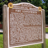
Frontier Army Museum (USPS 66027)
 |
| Heart of America Future Thought Leadership Learning Legends |
July 1, 2003 - December 30, 2003 - Richmond (VA)
Beyond Lewis & Clark: The Army Explores the West at the Virginia Historical Society, 428 North Boulevard.
To commemorate the bicentennial of the Louisiana Purchase by President Thomas Jefferson and the subsequent Lewis and Clark expedition, the Virginia Historical Society will be the opening venue for this important exhibition, a collaborative effort with the Kansas and Washington State historical societies, the U.S. Army's Frontier Army Museum, and the U.S. Army Center of Military History.
The Lewis and Clark expedition inaugurated a half century of western exploration led by the US Army, in which Meriwether Lewis and William Clark served as captains. Other expeditions were led by such renowned figures as Zebulon Pike and John C. Fremont. Moreover, in the decades before the Civil War, the army was the federal government's "public works department."
It identified the basic network of trails, surveyed the western topography, and laid the groundwork for roads and railroads. As this exhibit will make clear, it is impossible to overstate the role of the army in this critical period of national development.
The U.S. Army Engineer Museum has this mission:
Collecting, preserving, and interpreting
American military engineering material culture.
 ... Disaster assistance
for victims of hurricanes, floods, and earthquakes
continues as a peacetime challenge of the Corps.
For more than 200 years, miners, sappers, pontoneers, topogs-engineers, have contributed to the development of this nation and of developing nations. In war, engineers have been fighters and builders of those things needed to sustain the battle. If the past is simply a prologue of the future, engineers must continue to hone their ability to build, and if necessary, fight.
ART REVIEW:
Manifest Destiny: Moving West With Maps ...
|
ART REVIEW; Manifest Destiny: Moving West With Maps and Entertainment |
''Heading West: Mapping the Territory'' and ''Touring West: 19th-Century Performing Artists on the Oregon Trail'' take real estate and entertainment back to Square 1, providing sobering insights into our own corporate-driven, celebrity-crazed times and their racial and economic inequities.
Greener Roadsides Summer 2003 - FHWA
|
FHWA > HEP > Environment > Natural > Vegetation > Roadsides 5 Prairie demonstration sites ... - Cached - Similar pages |
KUTC Fall-05 final2
- View as HTML
FHWA, 2005. “Hey Flaggers: Heads Up!” poster. Kansas LTAP, 2006.
Prairie Passage in Kansas brochure. Kansas DOT, 2005. ...
www.kutc.ku.edu/cgiwrap/kutc/download.php?name=KUTCFall2005.pdf - Similar pages
A Catalyst for Change - Greener Roadsides
FHWA > HEP > Environment > Natural > Vegetation > Roadsides
... Nearly fifty percent of funds for the prairie passage in Kansas are devoted to educating ...
www.fhwa.dot.gov/environment/greenerroadsides/sum03p3.htm - Cached - Similar pages - Note this - KDOT has implemented a new mowing policy as part of its roadway maintenance program. The policy designates mowing heights and times to ensure vegetation is mowed on a schedule to enhance plant growth and protect wildlife habitat.
- As part of the public outreach and education program, KDOT developed a brochure in partnership with the Kansas Biological Survey, Audubon of Kansas, Kansas Turnpike Authority, and the Kansas Wildflower Society.
- Entitled Prairie Passage in Kansas, it describes and maps points of interest in the state’s prairie heritage. KDOT also produced Kansas Wildflowers, Native Grasses & Shrubs, a brochure that pictures wildflowers native to the state. To order in quantity, call KDOT at (785) 296-0160.
Management Craft: Management Trends?
| I'm NOW championing the "Prairie Passage in Kansas" using virtual team tactics ... Collaboratory (LLC) examples of emerging http://FutureThought.org ... - Cached - Similar pages - |
Exploration
... of the western territories and performing artists in those territories, respectively. ... |
Minnesota Futurists wiki / Five regions of the Future
An Association for the Study of Alternative Futures ...An Experimental WIKI |
NEKLS @ your library
Travel Restrictions: Kansas, Missouri. Availability: Call for dates – we usually ... |
Pathfinder Passports(cc): Dragonfly County Kansas:
... Five Regions of the Future; Futurethought Trails-n-Tails Wiki ... - Cached - Similar pages - Note this |
-
Pathfinder Passports(cc): 2007-03-18
-
aka Prairie Passage in Kansas)... Campus Futures .
... Five Regions of the Future; Futurethought Trails-n-Tails Wiki; wikkipedia geoWIZard Profile ...
geoventuring-lnt.blogspot.com/2007_03_18_archive.html - Cached - Similar pages - Note this
[ More results from geoventuring-lnt.blogspot.com ]
|
ALL-WinWin "MentorshipART" of Peace |
-
List of future studies topics
Relevance: 100.0% - -
-
Thought leader
Relevance: 100.0% - -
Thought leader is a buzzword or article of jargon used to describe a futurist or person who is recognized among their peer_mentors for innovative_ideas and demonstrates the confidence to promote or share those ideas as actionable distilled insights (thinklets).
- Leadership is deliberately causing ... people-driven actions
in a planned way to accomplish the leaders agenda. Phil Cosby[3]
-
See also
- Anticipatory thinking (futures)
- Futures studies
- Robert L. Gernon
- Marshall McLuhan
- Strategic management
- Edwin W. Rawlings
- Walter Roscoe Stubbs
- Paul White (journalist)
- Irma Wyman
External links
Heartland Circle Thought Leader Gatherings "A Community of Practice for the New Leader."
Retrieved from "http://en.wikipedia.org/wiki/Thought_leader"
Categories: Anticipatory thinking | Ethical Culture | Futurology