The University of Kansas (often referred to as KU or just Kansas) is a public research ....
Computing innovations. KU's School of Business launched ...
en.wikipedia.org/wiki/University_of_Kansas

|
|
|
|
|
Description: The sun sets behind the USS Arizona (BB 39) Memorial
as seen from the aircraft carrier USS Kitty Hawk (CV 63).
|

Uninvited Editorial: Let's Prove that Ed Tech Produces

This work is licensed under a
Creative Commons Attribution-NonCommercial-ShareAlike 4.0 International License.
Kunia Hawaii usps

Wheeler Army Airfield (Geography)
Wheeler Army Airfield, also known as Wheeler Field and formerly as Wheeler Air Force Base, is a United States Army post located in the City & County of Honolulu and in the Wahiawa District of the Island of O'ahu, Hawaii. It is a National Historic Landmark for its role in the December 7, 1941 Japanese attack on Pearl Harbor.
During 1969 , Fleet Operations Control Center, Pacific (FOCCPAC at Kunia)
on Oahu in Hawaii launched an Automated Control Environment (ACE) ...
- The third version of the PLATO computer-based educational system was implemented on a CDC-1604.
- The PLATO project was assumed by the Control Data Corporation (CDC), who built the machines with which PLATO operated at the University. CDC President William Norris planned to make PLATO a force in the computer world; the last production PLATO system was shut down in 2006 (coincidentally, just a month after Bill Norris died), yet it established key on-line concepts: forums, message boards, online testing, e-mail, chat rooms, picture languages, instant messaging, remote screen sharing, and multi-player games.
JOVIAL was used as the CDC 1604's main programming language while octal was used to program shared services supported by the CDC 160A. NAVCOSSACT based at the Washington Navy Yard provided systems and training support.
Legend
 Benchmark Not Yet Logged
 Benchmark May Be Missing
 Benchmark Marked Destroyed
 Benchmark Found/Recovered
By Coordinate: N 21° 27.471 W 158° 03.562 New Search
| Icon | PID | Dist | Designation | State | Type | Found | Last Log | d/l |
|---|
|
TU1628 |
0.3mi NE |
STATE SURVEY 9-11 1969 |
HI |
type not specified |
|
|
|
|
TU1630 |
0.9mi S |
KUNIA |
HI |
type not specified |
|
|
|
|
TU1631 |
1.1mi S |
KUNIA RADIO STA KAHU MAST |
HI |
type not specified |
03/23/2008 |
 |
|
|
TU1626 |
1.1mi N |
KUNIA FACILITY RADAR TOWER |
HI |
type not specified |
|
|
|
|
TU1632 |
1.3mi NW |
MAUNA UNA RESET |
HI |
type not specified |
01/20/2007 |
|
|
|
TU1629 |
1.3mi S |
STATE SURVEY 9-10 1969 |
HI |
type not specified |
|
|
|
|
TU1627 |
1.3mi N |
STATE SURVEY 9-12 1969 |
HI |
type not specified |
|
|
|
|
TU0657 |
1.8mi NE |
D 245 |
HI |
bench mark disk |
04/16/2005 |
|
|
|
TU1623 |
2mi NE |
WHEELER AFB CONTROL TOWER BCN |
HI |
type not specified |
|
|
|
|
TU0659 |
2mi N |
SCHOFIELD W BASE |
HI |
triangulation station disk |
|
|
|
|
TU1621 |
2.1mi NE |
WHEELER AFB AFCS REC FAC TOWER |
HI |
type not specified |
|
|
|
|
TU1625 |
2.2mi N |
SCHOFIELD LAUNDRY STACK |
HI |
type not specified |
|
|
|
|
TU1624 |
2.3mi N |
SCHOFIELD POST FLAG |
HI |
type not specified |
06/30/2007 |
|
|
|
TU0649 |
2.3mi E |
A 15 |
HI |
bench mark disk |
|
|
|
|
TU0650 |
2.5mi NE |
9 14 A |
HI |
survey disk |
05/28/2010 |
|
|
|
TU0662 |
2.6mi N |
G 245 |
HI |
bench mark disk |
01/20/2007 |
|
|
|
TU0661 |
2.6mi NE |
F 245 |
HI |
bench mark disk |
01/21/2008 |
|
|
|
TU0654 |
2.7mi NE |
SCHOFIELD MAGNETIC |
HI |
magnetic station disk |
|
|
|
|
TU0651 |
2.7mi NE |
SCHOFIELD E BASE RM 1 |
HI |
reference mark disk |
|
|
|
|
TU0653 |
2.7mi NE |
SCHOFIELD E BASE RM 2 |
HI |
reference mark disk |
|
|
|
|
TU0652 |
2.7mi NE |
SCHOFIELD EAST BASE |
HI |
triangulation station disk |
|
|
|
|
TU0648 |
2.8mi E |
Z 14 |
HI |
bench mark disk |
|
|
|
|
TU1635 |
2.8mi SW |
KAUA |
HI |
type not specified |
11/04/2006 |
|
|
|
TU0655 |
2.9mi NE |
7 1 |
HI |
survey disk |
|
|
|
|
TU1619 |
3mi NE |
STATE SURVEY 9-14 1969 |
HI |
type not specified |
|
|
|
Total Records: 553 - Page: 1 of 23
became U.S. Navy Meteorologist and oceanographer for CINCPACFLT until 1972


Visit website 155 Indian Avenue , Lawrence, KS 66046
Google Earth was originally developed by Keyhole, Inc., a Mountain View-based company founded in 2001.
Keyhole, after being spun off from Intrinsic Graphics, received funding from the Central Intelligence Agency's venture capital firm, In-Q-Tel[6]
Keyhole developed the program under the name Keyhole EarthViewer, and sold the product for uses in fields such as real estate, urban planning, defense, and intelligence. Google acquired the company in 2004,[9] driving public interest in geospatial technologies and applications.[10][11]
At exactly the same time that Google was trying to improve the NSA's internal search capabilities, the company was in negotiations with two other intelligence agencies: the Central Intelligence Agency and the National Geospatial-Intelligence Agency (NGA), a close cousin of the NSA that primarily deals with geospatial/satellite intel for both combat and civilian operations.
These negotiations had to do with Google's purchase of Keyhole, a tiny tech startup that developed 3-D mapping technology. The company's main product was an application called EarthViewer, which allowed users to fly and move around a virtual globe as if they were in a video game. Google purchased Keyhole in 2004 for an undisclosed sum, and folded its technology into what later became known as Google Earth.
At the time, Google's acquisition of Keyhole raised serious privacy concerns. The reason was simple: In 2003, just a year before Google bought Keyhole, the company was saved from bankruptcy by In-Q-Tel, a venture capital fund run by the CIA on behalf of the military and intelligence community. Until the CIA came along, Keyhole was on the brink of bankruptcy and was reduced to giving its software away for free to CNN in exchange for promotion and hawking it at real estate conventions.
Although the exact amount that In-Q-Tel invested into Keyhole is classified. What we do know is that the bulk of the funds didn't come from the CIA's intelligence budget — as they normally do with In-Q-Tel — but from the NGA, which provided the money on behalf of the entire "Intelligence Community." As a result, equity in Keyhole was held by two major intelligence agencies.
Keyhole's new investors did not sit on the sidelines, but aggressively involved themselves in the operation and evolution of the business. This was no secret. The CIA publicly discussed its involvement, writing on its promotional materials that the agency "worked closely with other Intelligence Community organizations to tailor Keyhole’s systems to meet their needs."
And they didn't waste any time: Just a few weeks after In-Q-Tel invested in Keyhole, an NGA official bragged its technology was already being deployed by the Pentagon to prepare U.S. forces for the invasion of Iraq. Keyhole was also being used by US TV networks to display cool dynamic maps in their coverage of the Iraq War.
Source-URL: https://pando.com/2014/03/07/the-google-military-surveillance-complex/

Comments (4)
Bob-RJ Burkhart said
at 2:08 pm on Jul 28, 2010
#
Bob-RJ Burkhart - LinkedIn
Lawrence, Kansas Area - Watershed Marshal at VFW Post 6654
Drafted Ocean Surveillance System functional requirements for World-Wide Military ...
As Assistant Navigator (TAD) detached from FOCCPAC (Kunia, HI), ...
http://www.linkedin.com/in/geowizard - Cached - Similar
#
"Swift Trust" Empowers MentorshipART of Peace - Podstock Southwest ...
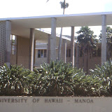
... graduate studies at UH-Manoa and drafted Ocean Surveillance System (OSS) ...
I was CincPacFlt's Sea Surveillance Officer at FOCCPAC-Kunia (Hawaii) while ...
http://podstocksw.ning.com/xn/detail/3463517:Comment:2996?xg_source...
Bob-RJ Burkhart said
at 2:03 pm on Jul 28, 2010
The crew assigned to work at this facility seemed to have been chosen using a NLPsyOps profiling protocol similar to those described by Eugene Burdick's "The 480" ... Its future history genre may have been inspired by his "Ugly American" co-author William Lederer (USNA 1936)
@ http://en.wikipedia.org/wiki/William_Lederer
Ugly American is an epithet used to refer to perceptions of loud, arrogant, demeaning, thoughtless and ethnocentric behavior of American citizens mainly abroad, but also at home.[1][2][3][4][5][6] Although the term is usually associated with or applied to travelers and tourists, it also applies to US corporate businesses in the international arena.[7][8][9][10][11] @ http://en.wikipedia.org/wiki/Ugly_American
Bob-RJ Burkhart said
at 1:17 pm on Jul 28, 2010
>> William J. Lederer was born on March 31, 1912, in New York City, the son of William Julius and Paula (Franken) Lederer.
He attended the United States Naval Academy, from which he graduated with a bachelor of science degree in 1936. Lederer's main career was in the U.S. Navy, from 1930 to 1958. He retired as captain. During wartime he served in Asia and with the Atlantic Fleet. From 1950 to 1958 he was special assistant to the commander-in-chief, Pacific. << Source-URL: http://www.enotes.com/ugly-american/biography
Bob-RJ Burkhart said
at 1:10 pm on Jul 28, 2010
Was Deputy CincPacFlt VADM David C. Richardson the model for USNA classmate's Ensign O'Toole and Me?
External links :: http://en.wikipedia.org/wiki/USS_Cimarron_%28AO-22%29#External_links
* Biography of Cimarron's first CO
* schneemann.com: USS Cimarron
o Cimarron Sea Stories (Search for: burkhart)
* Korean War Project Connections
* usni.org: Vice Admiral David C. Richardson (former Cimarron CO)
>>After duty in aviation planning for ComAirPac and OP-05, he was on the CinCSouth staff in Naples, then commanded the oiler Cimarron (AO-22) and ASW carrier Hornet (CVS-12).<< via http://www.usni.org/heritage/richardson
You don't have permission to comment on this page.