| 
  • If you are citizen of an European Union member nation, you may not use this service unless you are at least 16 years old.

  • You already know Dokkio is an AI-powered assistant to organize & manage your digital files & messages. Very soon, Dokkio will support Outlook as well as One Drive. Check it out today!

View
 

National Historic Trails Wayshowing

Page history last edited by Bob-RJ Burkhart 12 years, 6 months ago Saved with comment

Return to:  FFNHA-SFTA Palmyra Gravel Grinder ...  High-TEK Wayfinding ... Historic Trails ROCS mapXchange ...


Kanzana SFTA Historic Byways ... NPS-gov "Fort Larned" wayfinding  ... USNPS Virtual Caching


Prairie Passage :: What's Ahead?


http://i.creativecommons.org/l/by-nc-sa/2.5/ca/88x31.png This Wiki is licensed CC-BY-NC-SA - Creative Commons

Attribution-Noncommercial-Share Alike 3.0 License. Authors, learn more about your rights.


page 1


Item Description
 

Surveying Equipment
Author: No authors specified.
Date: 1845-1855


Albert D. Searl used this equipment to survey

Kansas Territory town sites in 1854.

Lawrence was surveyed on Sept. 25th and Topeka on Dec. 20th. Searl's efforts to set town limits for free-staters in Lawrence were met with violence from pro-slavery forces nearby.


Searl would later survey Manhattan, Osawatomie, Burlington, & El Dorado.

Location of Original: KSHS/Kansas Museum of History         Call Number: 1903.36.1, SNTE/Transit
Item Number: 102791              Number of images: 1
Keywords: Border ruffians; Burlington, Kansas Territory; Coffey County, Kansas Territory; Douglas County, Kansas Territory; Free state; Free state cause; Lawrence, Kansas Territory; Manhattan, Kansas Territory; Miami County, Kansas (see also Lykins County, Kansas Territory); Objects; Osawatomie, Kansas Territory; Riley County, Kansas Territory; Searl, Albert D.; Skirmishing; Surveyors; Topeka, Kansas; Topeka, Kansas Territory; Violence


Maps

Wichta State Univsersity Libraries, Department of Special Collections, Digitized Kansas Maps <http://specialcollections.wichita.edu/collections/maps/index.asp> An excellent collection of over 325 Kansas maps, dating from 1556 to 1900. There are over fifty maps from the territorial period. An interactive feature enables users to zoom in on map details.


Title: A new map of Texas, Oregon and California

with the regions adjoining, compiled from the most recent authorities
Content Date: 1846
Copyright Date: 1925
Author: Mitchell, S. Augustus
Other Author(s): Burroughs, H. N.
Publisher:
North Pacific Bank Note Co.
Size: 48 x 45 cm
 

Description:Includes topographic features.Indicates the locations of forts.

Shows the trails and routes identified as the Great Spanish Trail from P. Angelos (Pueblo de los Angelos, now Los Angeles) to Santa Fe, Lewis and Clarkes (sic) route and Frémont's route. Indicates Native American inhabitation.


Designates Oregon Trail as Oregon route on map and Emigrant Route from Missouri to Oregon in table of distances.

Identifies Santa Fe Trail as Caravan route to Santa Fe.
Call Number: 1846-0002

Picasa Web Albums - Bob-RJ Burkhart

Frontier-Military-Road-Waymarking. Freedom's Frontier National Heritage Area ...
Menor's Ferry Historic District. Sep 13, 2010. Photos: 38

picasaweb.google.com/RJBurkhart?​showall=true

  • Read the ebook The Kansas historical quarterly (Volume 29) ...

    By 1846 instead of 14 town of "Kansas" shareholders ...
    Development of Territorial Kansas" (microfilm, KHi); Historical ...
    Isaac M. C. Ellis was licensed to keep a ferry on ...

    www.ebooksread.com/authors-eng/kansas-state-historical-society/​the-kansas-historical...
 

High-TEK Watershed Orienteering Kit (WOK)

WorldFuture 2012

... Futurists combine the creativity for imagining a better future with the entrepreneurial drive to build it.
While the future may be the ... of the program for WorldFuture 2012 will rely on the rich history
of futurists sharing with each other. If you’d like to participate ...

Book page - lmathias - 09/23/2011 - 4:00pm - 0 comments - 0 attachments


Nuvi-1450LMT_xi-o06pm.gdb

Nuvi-1450LMT_xi-o06pm.gpx


Nuvi-1450LMT_xi-o06pm.tpo


Certified Sites on the Santa Fe NHT


The owners and managers of these historic sites and interpretive are “certified” partners
with the National Park Service on the Santa Fe National Historic Trail.

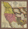
(updated April 6, 2010)


COLORADO


Boggsville Historic Site:

approximately two miles south of Las Animas on Colorado Highway 101

Hough-Baca House and Santa Fe Trail Museum:

312 E. Main St. (US Highways 160 and 350) between Chestnut and Walnut St., Trinidad

Trinidad Lake State Park:

 32610 State Highway 12, ‎five miles west of Trinidad, in the foothills of the Culebra Range of the Sangre de Cristo Mountains


KANSAS


Barton County Historical Society Museum: 85 S. Highway 281, Great Bend

Boot Hill Museum Ruts: 

nine miles west of Dodge City on the north side of U.S. Highway 50.

Buffalo Bill's Well (Beach Ranch Well): five miles west-southwest of Lyons

Coronado/Quivira Museum:

105 W. Lyon St. (at East Avenue S), Lyons, Rice County

Council Grove (Morris County) Sites:

* Council Oak: U.S. Highway 56 (E. Main St.), near N. 4th St., Council Grove

* Hays House (Restaurant): 112 W. Main St. (U.S. Highway 56) at Neosho St., Council Grove

* Hermit's Cave: Belfry St. near Hays St. (2 blocks north of Main St.), Council Grove

* Kaw Mission State Historic Sites:

500 North Mission St. (at Huffaker St.), Council Grove

* Last Chance Store: at the corner of Main St. (Highway 56) and Chatauqua St., at the west end of the Council Grove business district.

* Neosho Crossing:

just north of the US Highway 56 (Main St.) bridge over the Neosho River, Council Grove

* Pioneer Store: 131 W. Main St., Council Grove

* Post Office Oak: East Main St., near Vine St., Council Grove

* Seth Hays Home: on Wood St. near Hall St. (two blocks south of Main Street), Council Grove.

* Simcock House: 206 and 208 W. Columbia St., Council Grove

Cow Creek Crossing: six miles west-southwest of Lyons

Davis Segment/Ruts: nine miles north of Wilburton, Morton County

Gardner Museum: 204 W. Main St. (at Oak St.), Gardner, Johnson County

Harmon Park (Trail Swale):

Austin Harmon Park is located at 7727 Delmar St. (at 77th Place), Prairie Village.

The park is located one mile west of the Kansas-Missouri border.

Historic Adobe Museum:
(Grant County Museum): 300 E. Oklahoma (U.S. Highway 160) at S. Court St., Ulysses

Kern Ruts: near Chase, and just west of Ralph’s Ruts

Lanesfield School (Historic Site):

18745 S. Dillie Road, three miles southwest of Gardner

Lone Elm Campground:

in Lone Elm Park at corner of S. Lone Elm Road and W. 167th St., Olathe

Mahaffie Farmstead and Stagecoach Stop:

1200 E. Kansas City Road, adjacent to Kansas City Road Park (near N. Ridgeview Rd.), Olathe, Johnson County

Morton County Historical Society Museum: 370 E. US Highway 56, Elkhart

Pawnee Rock: located in Pawnee Rock State Historic Site, on Centre St. (SW 112th Ave.), one-half mile north of U.S. Highway 56 near the town of Pawnee Rock

Ralph’s Ruts: 422 Avenue L, near Chase, Rice County

Santa Fe Trail Center:

1349 Kansas Highway 156, which is two miles west of Larned

Sapling Grove: 8210 Grant Ave. (at 83rd Street), Overland Park

Shawnee Indian Mission State Historic Site: 

3403 W. 53rd St. (between Mission Rd. and Reinhardt St.), Fairway, Johnson County

Simmons Point Stage Station:
just north of U.S. Highway 56 (N. 300th Rd.) and just west of E. 550th Rd.,
near the crossroads community of Globe and 12 miles west of Baldwin City

Trail Corridor and Ruts:

one mile north of U.S. Highway 56 (N. 300th Rd.) and just west of E. 550th Rd.,
12 miles west of Baldwin City and just north of the Simmons Point Stage Station

Watkins Community Museum of History:

1047 Massachusetts Street, Lawrence, Douglas County


Comments (0)

You don't have permission to comment on this page.