NE-Kansas Freedom's Frontier Pathfinder Passports(cc) via 2006
Digital Jaywalker proof-of-concept for "GeoVenturing-LNT Memes Mapping" ...
... Site became part of a new "Freedom's Frontier National Heritage Area".
... en.wikipedia.org/wiki/Bleeding_Kansas
1.1 19th century; 1.2 20th Century; 1.3 Freedom's Frontier Heritage Area
... en.wikipedia.org/wiki/Fort_Leavenworth
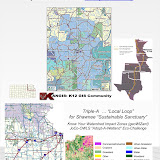
Freedom's Frontier · Kansas Territory: Frontier Military Scenic Byway
... It uses material from the Wikipedia article "Fort Scott National Historic Site".
... www.answers.com/topic/fort-scott-national-historic-site-1
 This Wiki is licensed CC-BY-NC-SA - Creative Commons
Attribution-Noncommercial-Share Alike 3.0 License. Authors, learn more about your rights.
geoventuring-lnt.blogspot.com/GeoVenturing
RO/CS (River Orienteering / Comunity Stewardship) ... SharePicasaWeb Album ...
wn.com/GeoVenturing
Author: GeoVenturing. Recorded at KSHS Grinter Place (Delaware Crossing)
October 17, 2009 using a Flip Video camcorder ... Visit: picasaweb.google.com ...
|
|
| ► 4:39► 4:39 |
www.youtube.com/watch?v=Jmpe6gc49gIMay 5, 2010 - 5 min - Uploaded by geoWIZard3
...http://picasaweb.google.com/RJBurkhart/MaliaSHOBTMayDayParade#... GeoVenturing-LNTrek to ...
|
|
|
| ► 3:41► 3:41 |
www.youtube.com/watch?v=u9ZD0C3lrjQAug 14, 2010 - 4 min - Uploaded by GeoVenturing
Digital Jaywalker Journal(cc) recorded with Flip Video camcorder :: http:// picasaweb.google.com ...
|
www.ouraaa.com/traveler/0005/tearsofb.html
A permanent Indian frontier. The Fort Leavenworth-Fort Scott-Fort Gibson Military Road
was constructed between 1838–1845 to link the military presence that ...
ceil.rootsweb.ancestry.com/transportation/trail-links.htm
Camp Supply to Ft. Sill Secondary military Road linking the two stations.
... occupied by a number of Plains Tribes at the time of the "Permanent Indian Frontier".
Rivers are both byways and barriers.
To understand history, F1RST understand rivers.

www.rootsweb.ancestry.com/~itgenweb/itprojects/roads/forts.htm
Dec 5, 2004 – I have encountered many references to "the Old Military Road" where
...number of Plains Tribes at the time of the "Permanent Indian Frontier".
-
www.hmdb.org/marker.asp?marker=50613
Jul 2, 2011 – The Fort Leavenworth Military Road as the route, by way of the Gum Springs
cut -off through modern day ... Permanent Indian Frontier
-
[PDF]
www.wnpa.org/research/fosc01-04.pdfFile Format: PDF/Adobe Acrobat - Quick Viewother U.S. Army forts that comprised the Pennanent Indian Frontier. ...
Road, it was used to transport military supplies, troops, Indian annuities and trade goods ...
-
digital.library.okstate.edu/encyclopedia/entries/M/MI025.html
A system of military roads, the first genuine roads in today's Oklahoma, were blazed... As the fiction of the "permanent Indian frontier" disappeared, Forts Gibson ...
-
[PDF]
www.kshs.org/publicat/history/2004winter_young.pdfFile Format: PDF/Adobe Acrobat - Quick Viewcommerce. Fort Scott, established in 1842, protected the military road along the. “ permanent Indian frontier” on the western edge of Missouri. In 1853 Fort Riley ...
-
archive.suite101.com › Kansas HistorySep 7, 2001 – FORT SCOTT: Outpost On The Indian Frontier ... Construction of amilitary road extending from Fort Snelling, Minnesota, to Fort Towson on the ...
-
attractions.uptake.com/kansas/pleasanton/126936973.htmlThe Frontier Military Road was used to provide soldiers and supplies to the forts along the "Permanent Indian Frontier". Fort Leavenworth and Fort Scott


Comments (1)
Bob-RJ Burkhart said
at 11:07 am on May 26, 2012
Preview Picasa Web album (PWA) :: https://picasaweb.google.com/110582475269910820742/FtLeavenworth1846MilitaryRoadMapXchange?authuser=0&authkey=Gv1sRgCMmak5S_rbD0hQE&feat=directlink
You don't have permission to comment on this page.